Lansing, Illinois
Lansing, Illinois | |
|---|---|
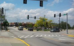
 Ridge Road in downtown Lansing | |
| Motto(s): "A community of pride, progress, and possibilities" | |
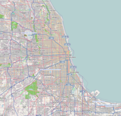
 Location of Lansing in Cook County, Illinois. | |
| Coordinates: 41°33′57″N 87°32′45″W / 41.56583°N 87.54583°W | |
| Country | United States |
| State | Illinois |
| County | Cook |
| Townships | Thornton, Bloom |
| Incorporated | 1893 |
| Government | |
| • Type | Mayor-Trustee |
| • Body | Board of Trustees |
| • Mayor | Patty Eidam |
| • Trustees | Saad Abbasy, Maureen Grady-Perovich, Brian Hardy, Micaela Smith, Leo Valencia, Jerry Zeldenrust |
| Area | |
| • Total | 7.52 sq mi (19.48 km2) |
| • Land | 7.46 sq mi (19.33 km2) |
| • Water | 0.06 sq mi (0.15 km2) 0.88% |
| Population (2020) | |
| • Total | 29,076 |
| • Density | 3,896.54/sq mi (1,504.42/km2) |
| Standard of living (2009-11) | |
| • Per capita income | $24,329 |
| • Median home value | $148,500 |
| ZIP code(s) | 60438 |
| Area code(s) | 708 |
| Geocode | 42028 |
| FIPS code | 17-42028 |
| Website | villageoflansing |
Lansing is a village in Cook County, Illinois, United States. Lansing is a south suburb of Chicago. The population was 29,076 at the 2020 census.[2]
History
[edit]The first family to settle in Lansing was that of August Hildebrandt in 1843. Henry, George, and John Lansing settled the area in 1846, which was incorporated in 1893. Early settlement in the village was primarily by Dutch and German immigrants. Industrial development of the surrounding Calumet region attracted immigrants from Ireland and Eastern Europe to the village in the 20th century. These settlement patterns are reflected in Lansing's current demographics; according to the census[3] the top five ancestries that were in Lansing in 2000 were German (17%), Polish (13%), Irish (13%), Dutch (11%), and Italian (7%). However, according to City-data.com 2016 estimates, these ancestries began to change in the mid-90s and early 2000s, when most residents were of African American ancestry (8,871), followed by Latinos (4,183), and Asian (Southeast Asian) (255).[4]
Geography
[edit]Lansing is 6.9 miles (11.1 km) south of the Chicago city limits at 138th Street, and 25.6 miles (41.2 km) from the Chicago Loop.
According to the 2021 census gazetteer files, Lansing has a total area of 7.52 square miles (19.48 km2), of which 7.46 square miles (19.32 km2) (or 99.24%) is land and 0.06 square miles (0.16 km2) (or 0.76%) is water.[5] Lansing sits on the Calumet Shoreline, an ancient shoreline of Lake Michigan.
Demographics
[edit]| Census | Pop. | Note | %± |
|---|---|---|---|
| 1900 | 830 | — | |
| 1910 | 1,060 | 27.7% | |
| 1920 | 1,409 | 32.9% | |
| 1930 | 3,378 | 139.7% | |
| 1940 | 4,462 | 32.1% | |
| 1950 | 8,682 | 94.6% | |
| 1960 | 17,475 | 101.3% | |
| 1970 | 22,916 | 31.1% | |
| 1980 | 28,958 | 26.4% | |
| 1990 | 28,131 | −2.9% | |
| 2000 | 28,332 | 0.7% | |
| 2010 | 28,331 | 0.0% | |
| 2020 | 29,076 | 2.6% | |
| U.S. Decennial Census[6] 2010[7] 2020[8] | |||
| Race / Ethnicity (NH = Non-Hispanic) | Pop 2000[9] | Pop 2010[7] | Pop 2020[8] | % 2000 | % 2010 | % 2020 |
|---|---|---|---|---|---|---|
| White alone (NH) | 23,238 | 14,681 | 8,462 | 82.02% | 51.82% | 29.10% |
| Black or African American alone (NH) | 2,983 | 8,847 | 13,421 | 10.53% | 31.23% | 46.16% |
| Native American or Alaska Native alone (NH) | 22 | 38 | 26 | 0.08% | 0.13% | 0.09% |
| Asian alone (NH) | 201 | 255 | 264 | 0.71% | 0.90% | 0.91% |
| Pacific Islander alone (NH) | 12 | 5 | 3 | 0.04% | 0.02% | 0.01% |
| Other race alone (NH) | 21 | 39 | 172 | 0.07% | 0.14% | 0.59% |
| Mixed race or Multiracial (NH) | 231 | 363 | 734 | 0.82% | 1.28% | 2.52% |
| Hispanic or Latino (any race) | 1,624 | 4,103 | 5,993 | 5.73% | 14.48% | 20.61% |
| Total | 28,332 | 28,331 | 29,076 | 100.00% | 100.00% | 100.00% |
As of the 2020 census[10] there were 29,076 people, 10,741 households, and 6,818 families residing in the village. The population density was 3,867.00 inhabitants per square mile (1,493.06/km2). There were 12,053 housing units at an average density of 1,603.01 per square mile (618.93/km2). The racial makeup of the village was 46.62% African American, 32.17% White, 0.72% Native American, 0.93% Asian, 0.02% Pacific Islander, 10.67% from other races, and 8.88% from two or more races. Hispanic or Latino of any race were 20.61% of the population.
There were 10,741 households, out of which 31.7% had children under the age of 18 living with them, 35.18% were married couples living together, 22.04% had a female householder with no husband present, and 36.52% were non-families. 31.80% of all households were made up of individuals, and 10.87% had someone living alone who was 65 years of age or older. The average household size was 3.23 and the average family size was 2.56.
The village's age distribution consisted of 24.2% under the age of 18, 7.2% from 18 to 24, 24.8% from 25 to 44, 26.6% from 45 to 64, and 17.2% who were 65 years of age or older. The median age was 40.2 years. For every 100 females, there were 77.7 males. For every 100 females age 18 and over, there were 73.6 males.
The median income for a household in the village was $57,659, and the median income for a family was $70,775. Males had a median income of $47,236 versus $31,684 for females. The per capita income for the village was $28,708. About 12.4% of families and 16.7% of the population were below the poverty line, including 27.8% of those under age 18 and 5.3% of those age 65 or over.
Government
[edit]The current mayor of Lansing is Patty Eidam, while the board of trustees is composed of Saad Abbasy, Maureen Grady-Perovich, Brian Hardy, Micaela Smith, Leo Valencia, and Jerry Zeldenrust. Vivian Payne is the Village Clerk.[11]
Lansing is represented in the United States Congress by Representative Robin Kelly, of Illinois's 2nd congressional district, as well as Senators Dick Durbin and Tammy Duckworth in the United States Senate.
Education
[edit]- College
- Visible Music College Chicago Branch
- Public high schools
- Private high schools
- Public primary and middle schools
- Memorial Junior High School
- Nathan Hale Elementary School
- Heritage Middle School
- Oak Glen Elementary School
- Reavis Elementary School
- Coolidge Elementary School
- Private primary and middle schools
Infrastructure
[edit]Transportation
[edit]Pace provides bus service connecting Lansing to destinations across the Southland.[14]
Notable people
[edit]- Bill W. Balthis (1936–2016), Illinois state representative, mayor of Lansing, and businessman[15]
- Tom Gorzelanny, pitcher for the Milwaukee Brewers, spent part of his childhood in Lansing[citation needed]
- Curtis Granderson, outfielder for the New York Mets, graduated from Thornton Fractional South High School
- Nnamdi Ogbonnaya, Musician
- Harry Smith, former co-anchor for CBS' The Early Show and the host of A&E's Biography series
- Pierre Thomas, running back for the New Orleans Saints, graduated from Thornton Fractional South High School
- Jack E. Walker, Illinois politician, practiced law in Lansing.[16]
See also
[edit]References
[edit]- ^ "2020 U.S. Gazetteer Files". United States Census Bureau. Retrieved March 15, 2022.
- ^ "Lansing village, Illinois". United States Census Bureau. Retrieved February 23, 2021.
- ^ "U.S. Census website". United States Census Bureau. Retrieved January 31, 2008.
- ^ "Why Blacks are choosing Lansing". February 8, 2018.
- ^ Bureau, US Census. "Gazetteer Files". Census.gov. Retrieved June 29, 2022.
{{cite web}}:|last=has generic name (help) - ^ "Decennial Census of Population and Housing by Decades". US Census Bureau.
- ^ a b "P2 Hispanic or Latino, and Not Hispanic or Latino by Race – 2010: DEC Redistricting Data (PL 94-171) – Lansing village, Illinois". United States Census Bureau.
- ^ a b "P2 Hispanic or Latino, and Not Hispanic or Latino by Race – 2020: DEC Redistricting Data (PL 94-171) – Lansing village, Illinois". United States Census Bureau.
- ^ "P004: Hispanic or Latino, and Not Hispanic or Latino by Race – 2000: DEC Summary File 1 – Lansing village, Illinois". United States Census Bureau.
- ^ "Explore Census Data". data.census.gov. Retrieved June 28, 2022.
- ^ "Village of Lansing Elected Officials". The Village of Lansing, IL. Village of Lansing. Retrieved August 22, 2024.
- ^ "Home". Lansing Christian School. June 12, 2023. Retrieved June 11, 2023.
- ^ "Eagle Academy Christian School – "Where Christian Scholars Take Flight"". Retrieved June 11, 2023.
- ^ "RTA System Map" (PDF). Retrieved January 31, 2024.
- ^ 'Illinois Blue Book 1995-1996,' Biographical Sketch of Biil W. Balthis, pg. 105
- ^ 'Illinois Blue Book 1973-1974, Biographical Sketch of Jack E. Walker, pg. 74


